Skip to main content
Search
Search This Blog
Gil's First GIS Blog
Posts
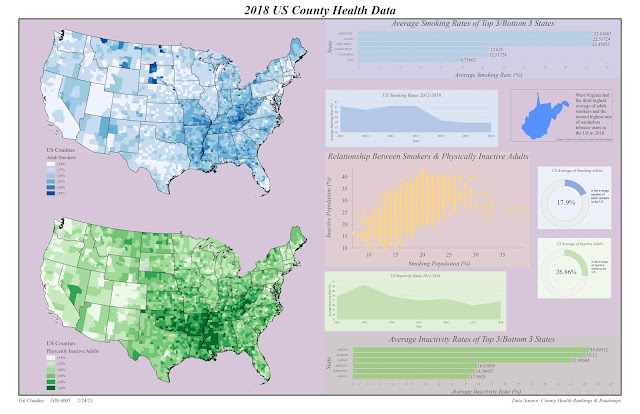
February 24, 2021
Infographics
February 17, 2021
Linear, Adjusted Progression, and Diverging Color Ramps
February 10, 2021
Hillshade on DEMs
February 03, 2021
Projected Coordinate Systems
January 27, 2021
Map Design and Typography
October 18, 2020
Scale and Spatial Data Aggregation
October 07, 2020
Interpolation
September 28, 2020
TINsDEMs
September 17, 2020
Testing Road Network Completeness
September 09, 2020
Testing Positional Accuracy
September 01, 2020
Precision vs. Accuracy
Newer Posts
Older Posts
Home